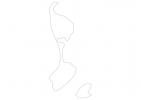
Saint Pierre and Miquelon Map - SVG Vector
Interactive Map of Saint Pierre and Miquelon
Saint Pierre and Miquelon is a Representative democracy founded in 1814 and located in the area of North America, with a land area of 243 km² and population density of 29 people per km². Territory of Saint Pierre and Miquelon borders Atlantic ocean. Gross domestic product (GDP) is of about 215300 millions of dollars dollars.
Geography of Saint Pierre and Miquelon
Morne de la Grande Montagne on Miquelon is the highest point in Saint Pierre and Miquelon at an altitude of 240 meters, instead the lowest point in the country is North Atlantic Ocean at sea level.
Simple Maps of Saint Pierre and Miquelon
Here are the best maps of Saint Pierre and Miquelon at high resolution. Below you find printable maps showing Saint Pierre and Miquelon in different styles and positions.
Frequently asked questions about Saint Pierre and Miquelon
How is Saint Pierre and Miquelon divided?
If you are looking for regions or provinces in Saint Pierre and Miquelon, here are all the main areas:
- Saint-Pierre
- Miquelon-Langlade
What are the main points of interest in Saint Pierre and Miquelon?
The major tourist attractions in Saint Pierre and Miquelon are Ile aux Marins, Grand Colombier, Arche Museum, Grand Barachois, Île aux Pigeons, Morne de la Grande Montagne, Île aux Vainqueurs, Pointe aux Canons Lighthouse, Heritage Museum.
What is the flag of Saint Pierre and Miquelon?
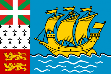
Flag of Saint Pierre and Miquelon
What is the capital of Saint Pierre and Miquelon?
The main city and capital of Saint Pierre and Miquelon is Saint-Pierre.
What is the currency in Saint Pierre and Miquelon?
Official currency of Saint Pierre and Miquelon is Euro.
What is the population of Saint Pierre and Miquelon?
In Saint Pierre and Miquelon there are 7000 people.
What is international phone code in Saint Pierre and Miquelon?
Saint Pierre and Miquelon telephone code is 508.
Other Country Maps in North America
Get Full Access
1) Access Map Editor
(create interactive maps)
2) Get 230+ country flags
(100% licensed vectors and images)
3) Get 230+ country maps
(100% licensed vectors and images) Get Full AccessOnly $4/month ($47 for 1 year)
After expiration, you have full licenses of all your downloads forever.