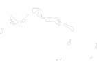
Turks and Caicos Islands Map - SVG Vector
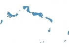
Interactive Map of Turks and Caicos Islands
Turks and Caicos Islands is a Constitutional monarchy founded in 1962 and located in the area of North America, with a land area of 431 km² and population density of 88 people per km². Territory of Turks and Caicos Islands borders Atlantic ocean. Gross domestic product (GDP) is of about 100 millions of dollars dollars.
Geography of Turks and Caicos Islands
Blue Hills on Providenciales is the highest point in Turks and Caicos Islands at an altitude of 49 meters, instead the lowest point in the country is North Atlantic Ocean at sea level.
Simple Maps of Turks and Caicos Islands
Here are the best maps of Turks and Caicos Islands at high resolution. Below you find printable maps showing Turks and Caicos Islands in different styles and positions.

Frequently asked questions about Turks and Caicos Islands
How is Turks and Caicos Islands divided?
If you are looking for regions or provinces in Turks and Caicos Islands, here are all the main areas:
- Providenciales and West Caicos
- South Caicos and East Caicos
- Middle Caicos
- North Caicos
- Grand Turk
- Salt Cay
What are the main points of interest in Turks and Caicos Islands?
The major tourist attractions in Turks and Caicos Islands are Grace Bay Beach, Parrot Cay, Salt Cay, Long Bay Beach, Grand Turk Cruise Center, Pine Cay, Chalk Sound Drive, Sapodilla Bay, Turtle Cove.
What is the flag of Turks and Caicos Islands?
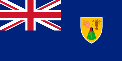
Flag of Turks and Caicos Islands
What is the capital of Turks and Caicos Islands?
The main city and capital of Turks and Caicos Islands is Cockburn Town.
What is the currency in Turks and Caicos Islands?
Official currency of Turks and Caicos Islands is Dollar.
What is the population of Turks and Caicos Islands?
In Turks and Caicos Islands there are 38000 people.
What is international phone code in Turks and Caicos Islands?
Turks and Caicos Islands telephone code is 1-649.
Other Country Maps in North America
Get Full Access
1) Access Map Editor
(create interactive maps)
2) Get 230+ country flags
(100% licensed vectors and images)
3) Get 230+ country maps
(100% licensed vectors and images) Get Full AccessOnly $4/month ($47 for 1 year)
After expiration, you have full licenses of all your downloads forever.