Antigua and Barbuda Map - SVG Vector
Interactive Map of Antigua and Barbuda
Antigua and Barbuda is a Constitutional monarchy founded in 1981 and located in the area of North America, with a land area of 444 km² and population density of 221 people per km². Territory of Antigua and Barbuda borders the sea. Gross domestic product (GDP) is of about 122000 millions of dollars dollars.
Geography of Antigua and Barbuda
Boggy Peak on Antigua is the highest point in Antigua and Barbuda at an altitude of 402 meters, instead the lowest point in the country is Caribbean Sea at sea level.
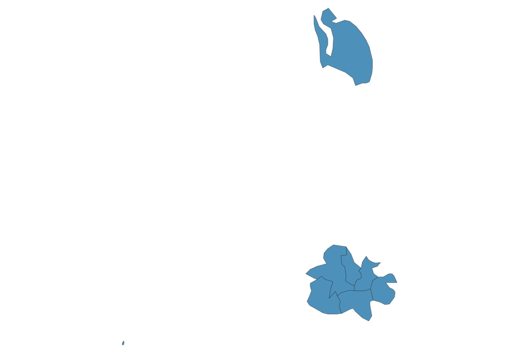
Simple Maps of Antigua and Barbuda
Here are the best maps of Antigua and Barbuda at high resolution. Below you find printable maps showing Antigua and Barbuda in different styles and positions.


Frequently asked questions about Antigua and Barbuda
How is Antigua and Barbuda divided?
If you are looking for regions or provinces in Antigua and Barbuda, here are all the main areas:
- Saint Paul
- Saint Philip
- Saint Peter
- Saint George
- Saint John
- Saint Mary
- Barbuda
- Redonda
What are the main points of interest in Antigua and Barbuda?
The major tourist attractions in Antigua and Barbuda are Nelson’s Dockyard, Long Island, Dickenson Bay, Fort James, Darkwood Beach, Fort Barrington, Shirley Heights Lookout, Stingray City Antigua, Galley Bay.
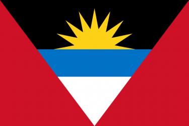
What is the flag of Antigua and Barbuda?
What is the capital of Antigua and Barbuda?
The main city and capital of Antigua and Barbuda is St. John’s.
What is the currency in Antigua and Barbuda?
Official currency of Antigua and Barbuda is Dollar.
What is the population of Antigua and Barbuda?
In Antigua and Barbuda there are 98100 people.
What is international phone code in Antigua and Barbuda?
Antigua and Barbuda telephone code is 1-268.
Other Country Maps in North America
Get Full Access
1) Access Map Editor
(create interactive maps)
2) Get 230+ country flags
(100% licensed vectors and images)
3) Get 230+ country maps
(100% licensed vectors and images) Get Full AccessOnly $4/month ($47 for 1 year)
After expiration, you have full licenses of all your downloads forever.