Micronesia Map - SVG Vector
Interactive Map of Micronesia
Micronesia is a Republic founded in 1979 and located in the area of Oceania, with a land area of 703 km² and population density of 164 people per km². Territory of Micronesia borders Pacific ocean. Gross domestic product (GDP) is of about 339000 millions of dollars dollars.
Geography of Micronesia
Nanlaud on Pohnpei is the highest point in Micronesia at an altitude of 782 meters, instead the lowest point in the country is North Pacific Ocean at sea level.
Simple Maps of Micronesia
Here are the best maps of Micronesia at high resolution. Below you find printable maps showing Micronesia in different styles and positions.


Frequently asked questions about Micronesia
How is Micronesia divided?
If you are looking for regions or provinces in Micronesia, here are all the main areas:
- Kosrae
- Pohnpei
- Chuuk
- Yap
What are the main points of interest in Micronesia?
The major tourist attractions in Micronesia are Nan Madol, ジープ島, Ulithi, Kepirohi Waterfall, Pingelap Atoll, Satawal, Yap Islands, Kosrae Island, Sokehs Island.
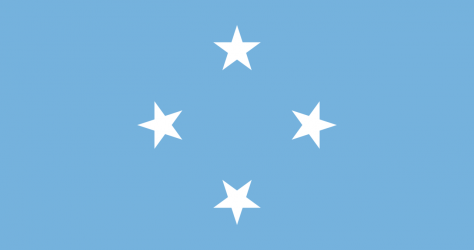
What is the flag of Micronesia?
What is the capital of Micronesia?
The main city and capital of Micronesia is Palikir.
What is the currency in Micronesia?
Official currency of Micronesia is Dollar.
What is the population of Micronesia?
In Micronesia there are 115200 people.
What is international phone code in Micronesia?
Micronesia telephone code is 691.
Other Country Maps in Oceania
Get Full Access
1) Access Map Editor
(create interactive maps)
2) Get 230+ country flags
(100% licensed vectors and images)
3) Get 230+ country maps
(100% licensed vectors and images) Get Full AccessOnly $4/month ($47 for 1 year)
After expiration, you have full licenses of all your downloads forever.