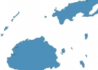
Fiji Map - SVG Vector
Interactive Map of Fiji
Fiji is a Republic founded in 1970 and located in the area of Oceania, with a land area of 18271 km² and population density of 49 people per km². Territory of Fiji borders the sea. Gross domestic product (GDP) is of about 421800 millions of dollars dollars.
Geography of Fiji
Tomanivi on Viti Levu is the highest point in Fiji at an altitude of 1324 meters, instead the lowest point in the country is South Pacific Ocean at sea level.
Simple Maps of Fiji
Here are the best maps of Fiji at high resolution. Below you find printable maps showing Fiji in different styles and positions.

Frequently asked questions about Fiji
How is Fiji divided?
If you are looking for regions or provinces in Fiji, here are all the main areas:
- Eastern
- Western
- Central
- Northern
- Rotuma
What are the main points of interest in Fiji?
The major tourist attractions in Fiji are Mamanuca Islands, Qalito Island, Garden of the Sleeping Giant, Mana Island, Tavarua, Malolo, Fijis Museum, Kula WILD Adventure Park, Sri Siva Subramaniya Swami Temple.
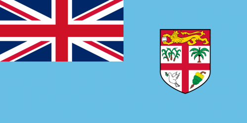
What is the flag of Fiji?
What is the capital of Fiji?
The main city and capital of Fiji is Suva.
What is the currency in Fiji?
Official currency of Fiji is Dollar.
What is the population of Fiji?
In Fiji there are 897100 people.
What is international phone code in Fiji?
Fiji telephone code is 679.
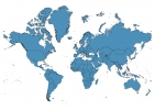
Other Country Maps in Oceania
Get Full Access
1) Access Map Editor
(create interactive maps)
2) Get 230+ country flags
(100% licensed vectors and images)
3) Get 230+ country maps
(100% licensed vectors and images) Get Full AccessOnly $4/month ($47 for 1 year)
After expiration, you have full licenses of all your downloads forever.