Wallis and Futuna Map - SVG Vector
Interactive Map of Wallis and Futuna
Wallis and Futuna is a Devolved parliamentary dependency founded in 1887 and located in the area of Oceania, with a land area of 275 km² and population density of 69 people per km². Territory of Wallis and Futuna borders Pacific ocean. Gross domestic product (GDP) is of about 18800 millions of dollars dollars.
Geography of Wallis and Futuna
Mont Puke on Futuna is the highest point in Wallis and Futuna at an altitude of 524 meters, instead the lowest point in the country is South Pacific Ocean at sea level.
Simple Maps of Wallis and Futuna
Here are the best maps of Wallis and Futuna at high resolution. Below you find printable maps showing Wallis and Futuna in different styles and positions.


Frequently asked questions about Wallis and Futuna
How is Wallis and Futuna divided?
If you are looking for regions or provinces in Wallis and Futuna, here are all the main areas:
- Sigave
- Alo
- `Uvea
What are the main points of interest in Wallis and Futuna?
The major tourist attractions in Wallis and Futuna are Horne Islands, Lake Lalolalo, Talietumu, Mata-Utu Cathedral, Mont Puke, Nukuhifala, Lac Kikila, Lac Lanutavake, Nukufotu.
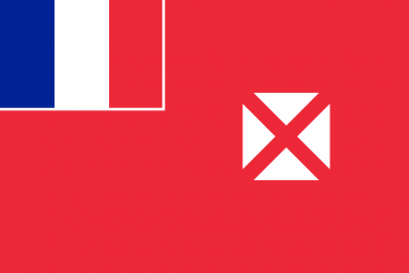
What is the flag of Wallis and Futuna?
What is the capital of Wallis and Futuna?
The main city and capital of Wallis and Futuna is Mata Utu.
What is the currency in Wallis and Futuna?
Official currency of Wallis and Futuna is Franc.
What is the population of Wallis and Futuna?
In Wallis and Futuna there are 19000 people.
What is international phone code in Wallis and Futuna?
Wallis and Futuna telephone code is 681.
Other Country Maps in Oceania
Get Full Access
1) Access Map Editor
(create interactive maps)
2) Get 230+ country flags
(100% licensed vectors and images)
3) Get 230+ country maps
(100% licensed vectors and images) Get Full AccessOnly $4/month ($47 for 1 year)
After expiration, you have full licenses of all your downloads forever.